ALL RIGHTS RESERVED
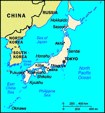
KANTO PLAINS
| Geographical basin area NW, W and SE of Tokyo, including major cities of Yokohama / Yokosuka. Small view for orientation purposes! | ![[IMAGE]](yohimap3.gif) |
|
| Expanded view - file size 137,302 bytes | ![[IMAGE]](kplains.gif) |
TOKYO
| 1948 HUGE HUGE MAP - long loading time. Go to external site and select MAPS. See street and building names. | ||
| 1991 Satellite view from space - external link.
Downloading of "Viewer" may be required - at your risk.
|
|
YOKOHAMA
| 1949 Map - Shows all areas including "quarters w/numbers" where you lived, streets and building names, use. HUGE HUGE size map -- slow loading on some computers. On external site -- click on link to site and then select MAPS. | ![[IMAGE]](15crdtmb.jpg) |
|
| 1991 Satellite view from space - external
link. Downloading of "Viewer" may be required - at your risk.
|
|
|
| 1953 Map -- Original -- without "cleanup" or annotations. LARGE file -- 295, 615 bytes -- slow loading. | 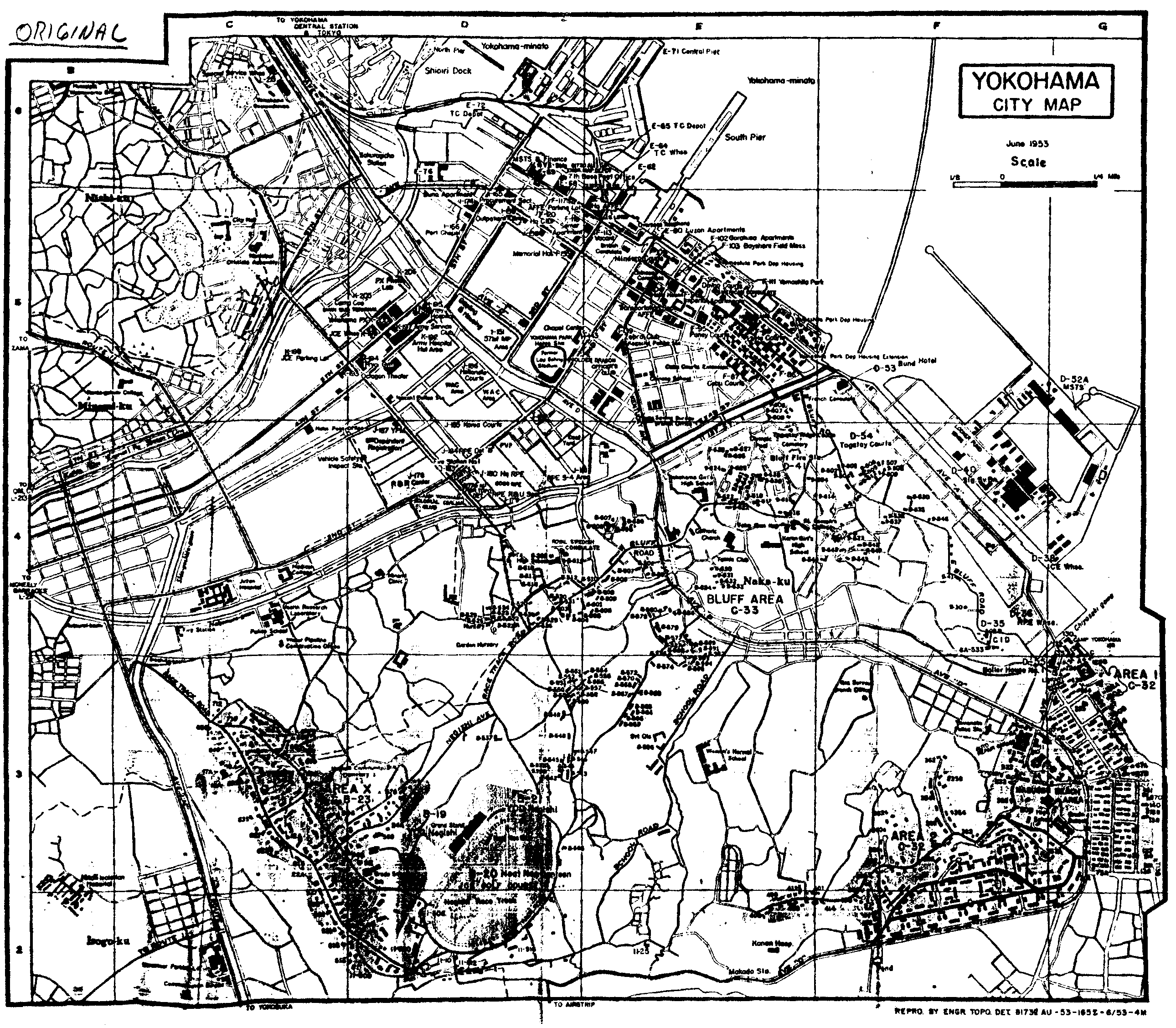 |
|
| 1953 Map -- With annotations showing all areas and facilities, including "Beach" - LARGE file -- 275, 084 bytes -- slow loading. | ![[IMAGE]](yohimap2.gif) |
|
| All areas of city -- 1946-1971 period. [By Bob Bonn] | ![[IMAGE]](yokohmap.gif) |
|
| Downtown and Bluff area -- 1946-1971. [By Bob Bonn] |  |
|
| Downtown and Bluff area -- 1946-1971 period -- second view. [By Bob Bonn] | ![[IMAGE]](yohimap1.gif) |
|
| Nasugbu "Beach" [Hommoku] area sketch - American School and Community Center facilities - partial - 1940's - 1970's. [By Bob Bonn] | ![[IMAGE]](beacha.gif) |
|
| Sketch of Hommoku area -- 1940's-70's. | 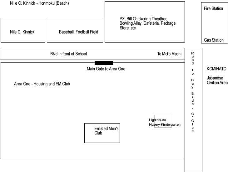 |
|
| Nasugbu "Beach" American School (YO-HI) Floorplan. [By Bob Bonn] | ![[IMAGE]](beachpln.gif) |
|
| 1965 Sketch. |  |
|
| 1966 Sketch. | 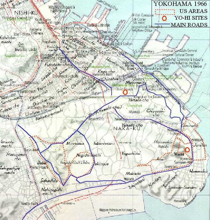 |
|
| 1966 Sketch -- expanded. | 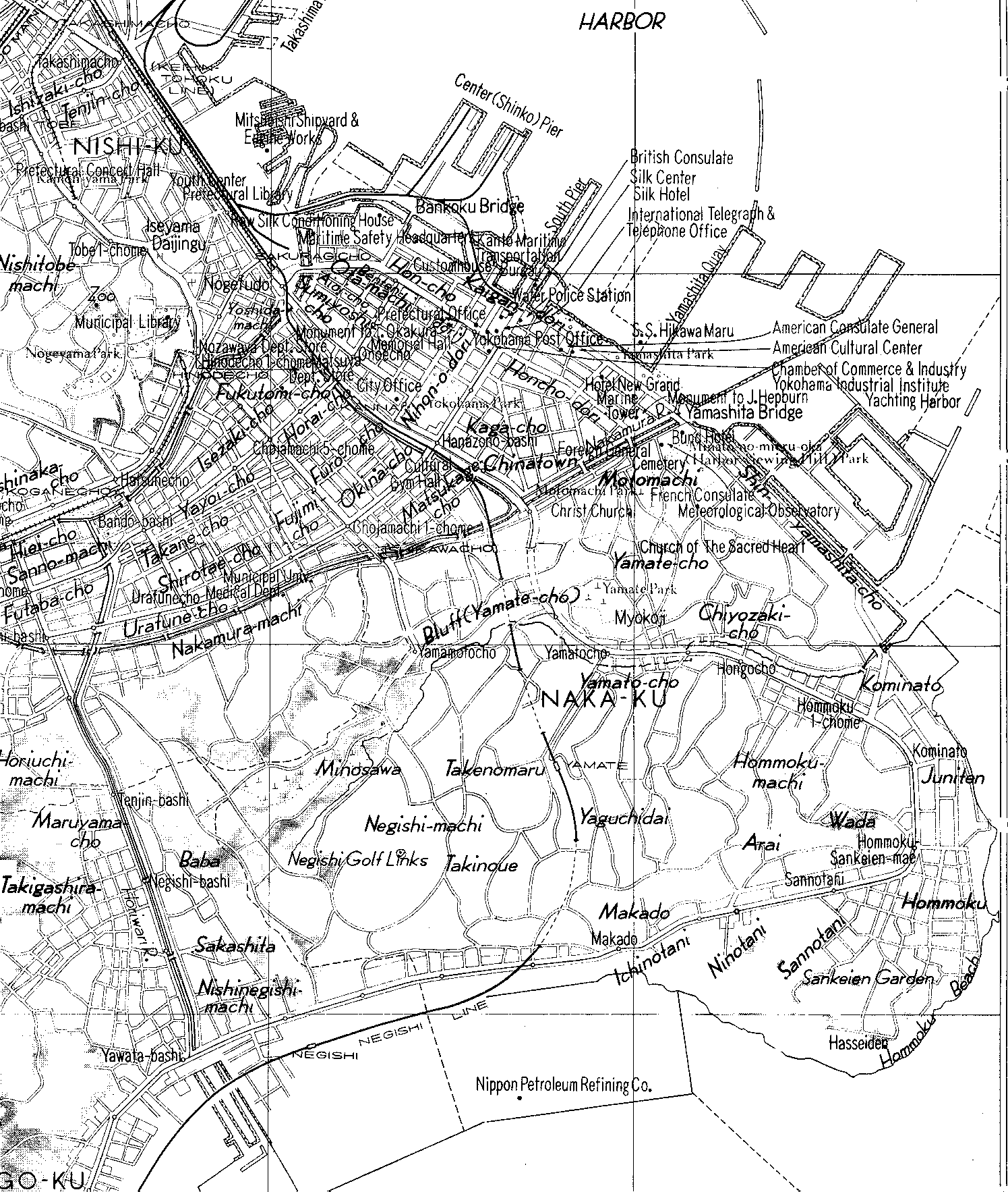 |
|
| 1995 city sketch. | ![[IMAGE]](yoko1995.gif) |
|
| Center Pier (now called Yokohama North Dock) - 2000 - - A sub-installation of USARJ, and is located in the city of Yokohama, Kanagawa Prefecture, Honshu, Japan. Photo courtesy of USARJ. | ![[IMAGE]](nothdock.jpg) |
|
| "NEW MADE LAND" areas. The land area of Yokohama has been enlarged over the last 50 years by dredging and other construction - perhaps by 50 percent. The Hommoku area and the Western part of Tokyo bay appear to have had the most commercial and industrial expansion. Thus, an explanation as to what happened to the "Beach". [By Bob Bonn] | ![[IMAGE]](newland.gif) |
|
| NEW MADE LAND usage examples from the Hommoku and Bay area: | ||
| South Hommoku area | 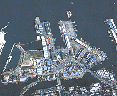 |
|
| East Hommoku area | 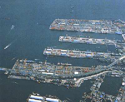 |
|
| From SE end of Yamashita Park | 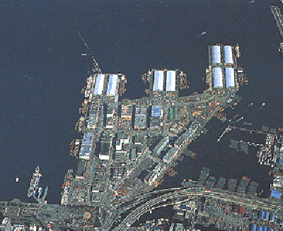 |
|
| Expanded / Improved South Pier | 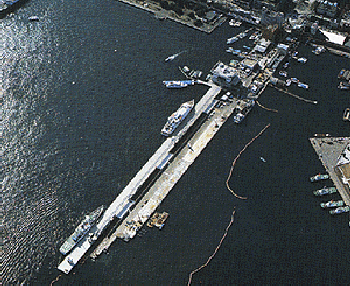 |
YOKOSUKA
| 1991 Satellite view from space - external
link. Downloading of "Viewer" may be required - at your risk.
|
|
|
| Yokosuka Navy Base - 1999. Courtsey FAY. | ![[IMAGE]](suka1.jpg) |
|
| Yokosuka Navy Base - 1963 vs 1998. | ![[IMAGE]](sukatmb.jpg) |
|
| 1964 Sketch. |  |
|
| Yokosuka Navy Base aerial photo - 1996. | ![[IMAGE]](yosuka3.jpg) |
|
| Yokosuka Navy Base aerial photo - 1996. | ![[IMAGE]](yosuka5.jpg) |
|
| Yokosuka Navy Base aerial photo - 1996. | ![[IMAGE]](yosuka6.jpg) |
|
| Yokosuka Community Center area - 1950's - 1960's. [By Bob Bonn] | ![[IMAGE]](sukamall.gif) |
|
| Yokosuka Sullivans School area - 1950's - 1960's. [By Bob Bonn] | ![[IMAGE]](sullimap.gif) |
OTHER
| Camp Zama, Camp Fuchinobe, Sagamihara Housing - 1940's. | ![[IMAGE]](zama.gif) |
|
| Camp Zama - Located about 25 miles southwest of central Tokyo in the cities of Zama and Sagamihara in Kanagawa Prefecture, Honshu, Japan. Camp Zama is home to the U.S. Army Japan/9th Theater Army Area Command. Photo courtesy of USARJ. | ![[IMAGE]](zama1.gif) |
|
| Sagamihara Housing Area - A sub-installation of USARJ, located in the city of Sagamihara, Kanagawa Prefecture, Honshu, Japan. It includes 627 family housing units, a commissary, the Arnn Elementary School. SHA is about fifteen minutes by car from Camp Zama and about twenty-five minutes from Sagami Depot. Photo courtesy of USARJ. | ![[IMAGE]](saga1.jpg) |
|
| Sagami (Engineer) Depot - A sub-installation of USARJ, located in the city of Sagamihara, Kanagawa Prefecture, Honshu, Japan. Photo courtesy of USARJ. | ![[IMAGE]](sagdepot.jpg) |
|
| Mount Fujiyama -- 1945. LARGE file -- 272, 190 bytes -- slow loading. | 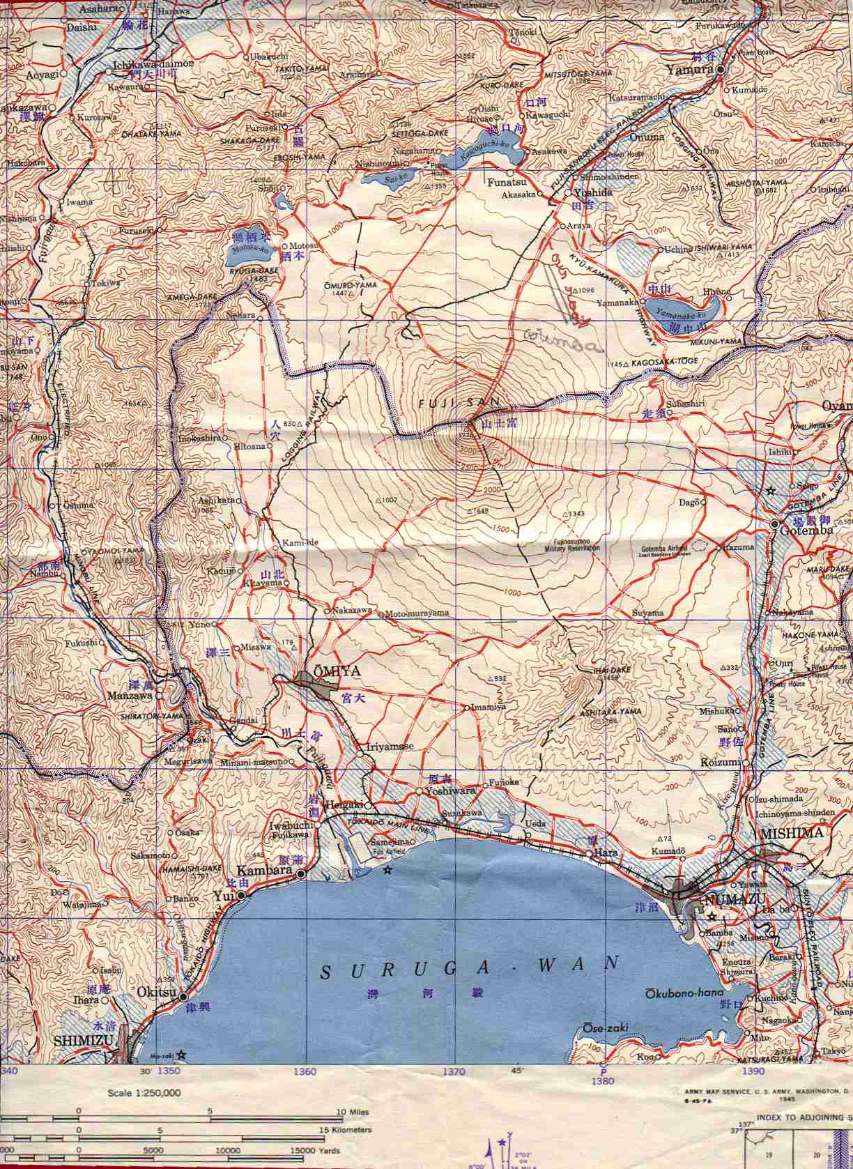 |
ALL RIGHTS RESERVED