MORE MAPS
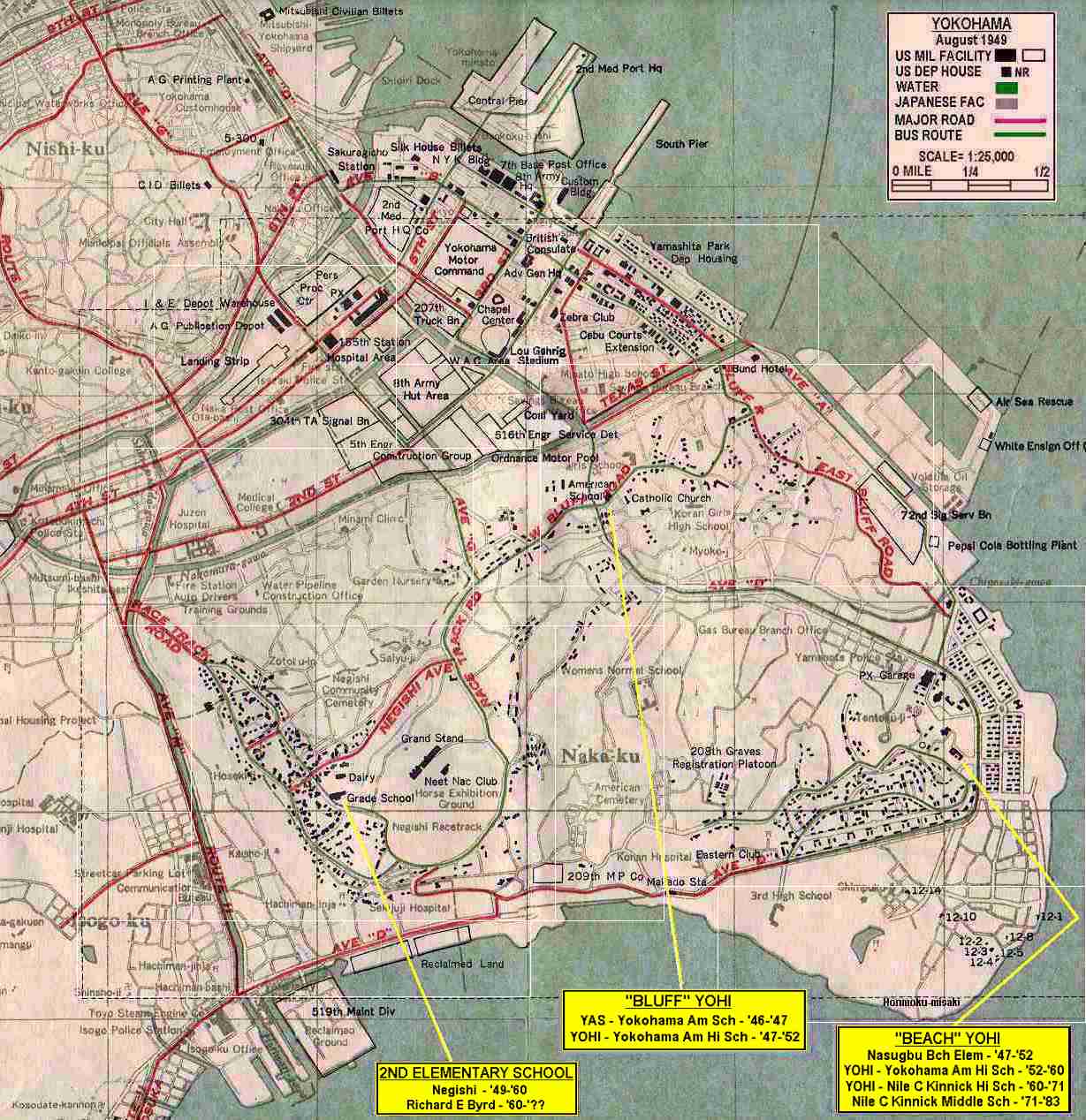
1949 YOKOHAMA CITY MAP
SCALE = 1:25,000 (see more area - further away)
View the above map first to familiarize yourself to the layout of the city. Visualize it divided into many overlapping sections. Note that the map has 13 rectangles on its surface which are indicated by very thin white lines. These rectangles denote sections of the map which if "clicked", will take you to another map showing just that section, and the scale will allow you a closer view with MUCH MORE DETAIL. If your equipment will not permit you to load the section maps by clicking on the "rectangles" you may use the sectionalized map table below.
CAN YOU LOCATE WHERE YOU LIVED?
SECTIONALIZED MAP TABLE
SCALE = 1:7,000 (see less area - close in - more detail)
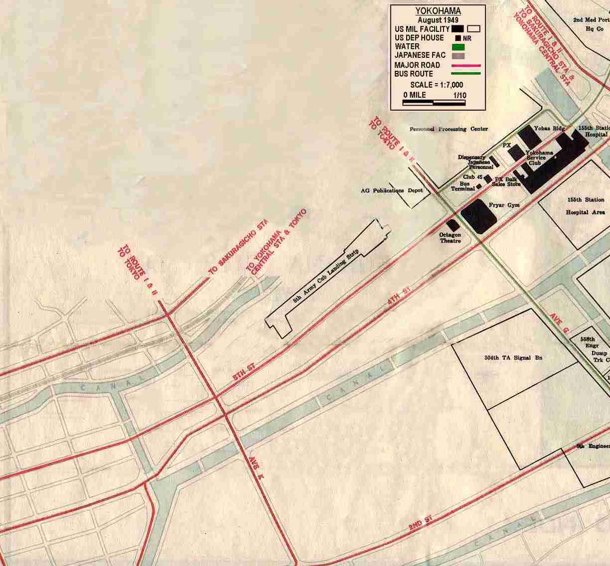
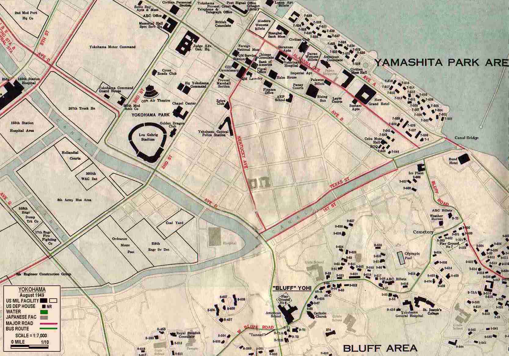
| NORTH WEST SECTION - Downtown Yokohama, PX, Fryar Gym, Octagon Thea - 15ymp10.jpg - 80,635 bytes | MIDDLE 15ymp06.jpg - 80,839 bytes | NORTH EAST SECTION- Downtown Yokohama, Yamashita Park (#22 was the "Hyatt House '47/'48") - 15ympcty.jpg - 173,836 bytes |
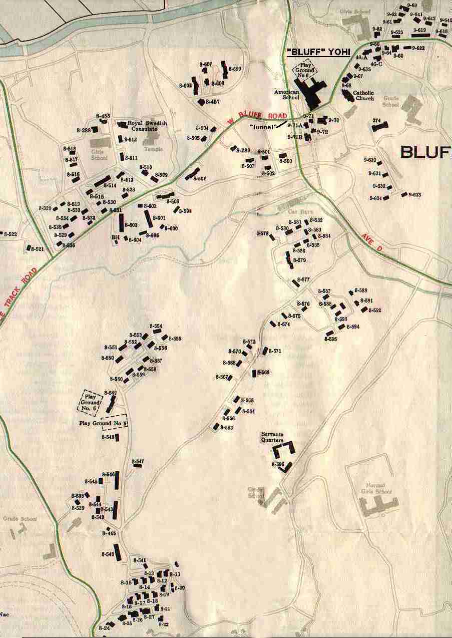
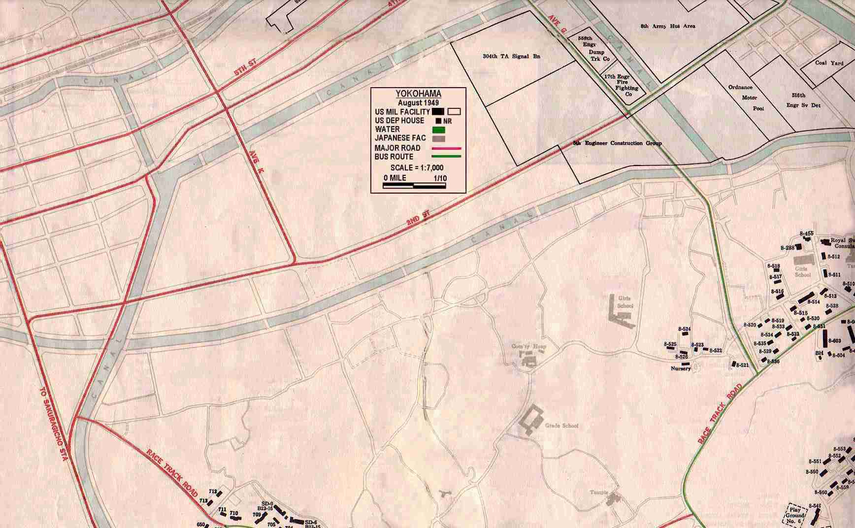
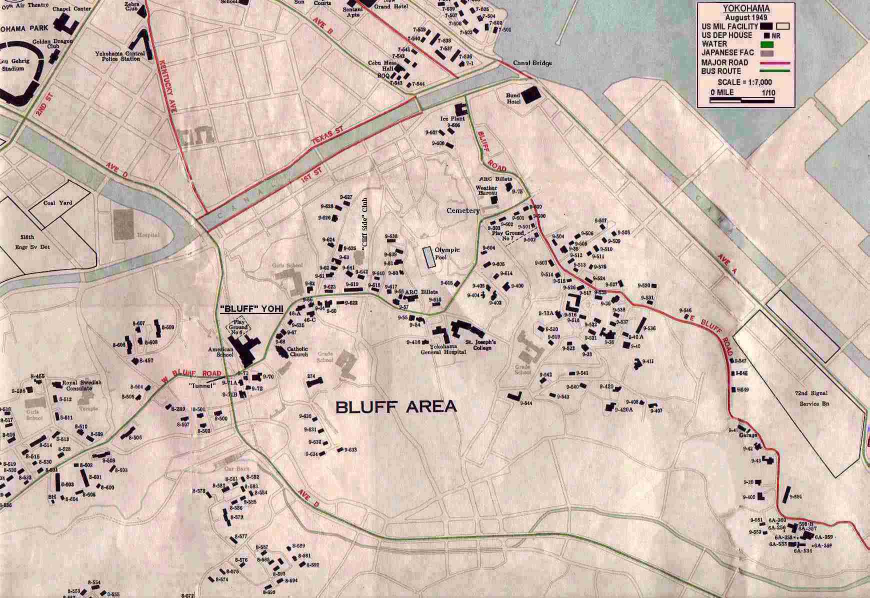
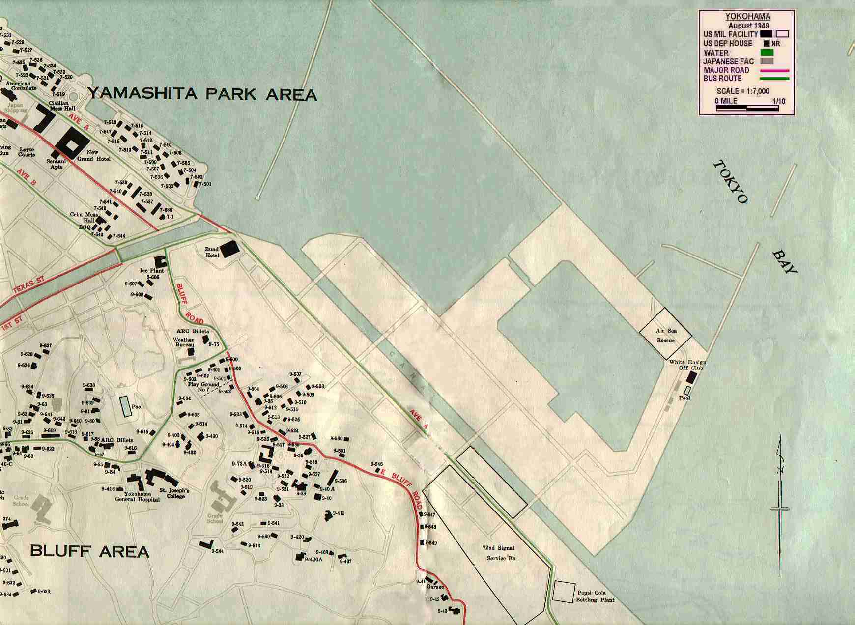
| MIDDLE WEST SECTION 1 - West Bluff and North end of Area X - 15ymp09.jpg 116,215 bytes | MIDDLE EAST SECTION 1- Northeast Bluff - Includes "Bluff" YO-HI, St Joseph - 15ympblf.jpg - 156,565 bytes | |
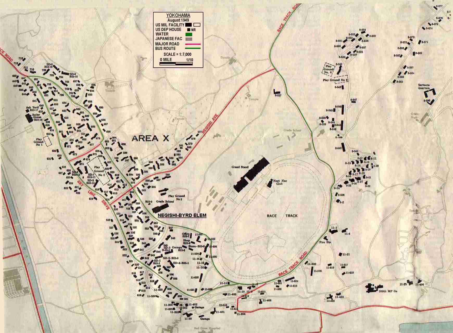
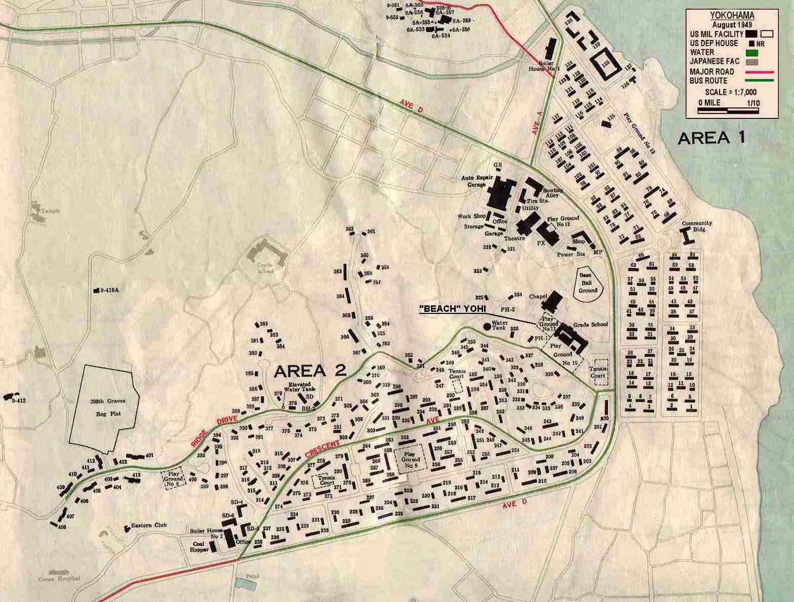
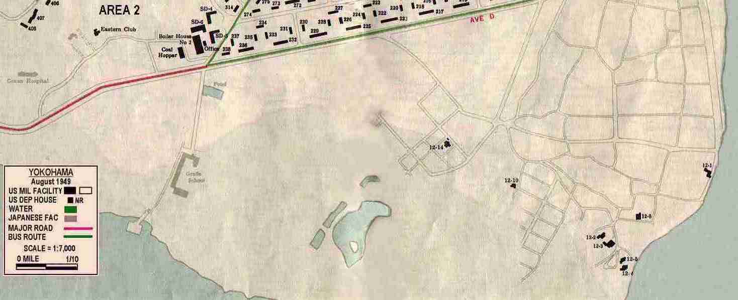
| MIDDLE WEST SECTION 2 - Area X (Negishi Heights) - Includes Neghish/Byrd Elementary, Neetnac, "Race" Track - 15ymparx.jpg - 137,165 bytes | MIDDLE 15ymp07.jpg - 42,168 bytes | MIDDLE EAST SECTION 2- Southeast Bluff, "Beach" Area 1 & 2 - Includes "Beach" YO-HI - 15ymp02.jpg - 134,939 bytes |
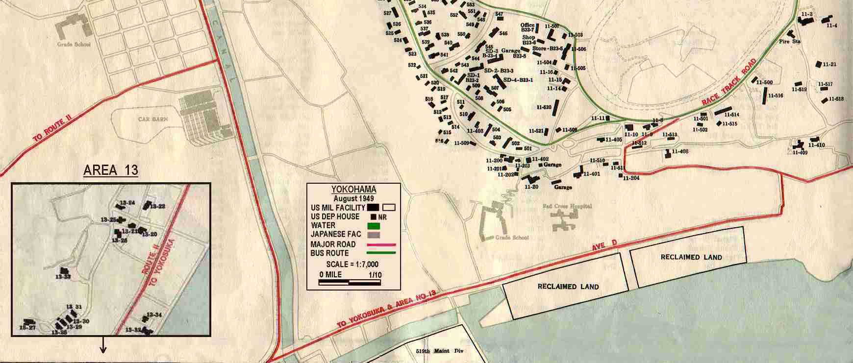
| SOUTH WEST SECTION - South end of Area X, Area 13, Road to Kamakura, Yokosuka - 15ymp08.jpg - 129,396 bytes | SOUTH EAST SECTION - South "Beach" - Did you live way out here? - Several did, including the owner of this map - Carolyn Cartwright Gorham lived in #12-3 and was picked up for school by a "jeep" - 15ymp01.jpg - 51,890 bytes |
IMPORTANT SITE / FACILITIES INDEX
The following index is prepared for those of you not familiar with the location of certain facilities. Determine the item by name that you want to locate, then click on the MAPLINK and you will be taken to the map that facility is located on. Facilites that were constructed / acquired and or identifed after the map was created in 1949 are shown below in this color.
| NAME | MAP LINK |
| ALLEY, BOWLING | 15ymp02 |
| BAYVIEW AREA | 15ymp02 |
| BRIDGE, CANAL | 15ympcty |
| CEMETERY, INTERNATIONAL | 15ympblf |
| CHAPEL, "BEACH" | 15ymp04 |
| CHAPEL, CENTRAL | 15ympcty |
| CHURCH, OF CHRIST | 15ympcty |
| CHURCH, SACRED HEART | 15ympcty |
| CLUB, "CLIFF SIDE" | 15ympblf |
| CLUB, GOLDEN DRAGON | 15ympcty |
| CLUB, "NEET-NAC" - "BLUFF" | 15ymparx |
| CLUB, "NEET-NAC" - "BEACH" | 15ymp02 |
| CLUB, SERVICE | 15ymap01 |
| CLUB, ZEBRA | 15ympcty |
| COMMISSARY, "BEACH" | 15ymp02 |
| CONSULATE, USA | 15ympcty |
| DISPENSARY, 332ND GENERAL | |
| FIRE ENGINE HILL | 15ymp02 |
| GRANDSTANDS | 15ymparx |
| GYM, FRYAR | 15ymp10 |
| HALL - MEMORIAL | 15ympcty |
| HOSPITAL, 155TH | 15ymp10 |
| HOSPITAL, YOKOHAMA GENERAL | 15ympblf |
| HOTEL, BUND | 15ympcty |
| HOUSING AREA - AREA 1 | 15ymp02 |
| HOUSING AREA - AREA 13 | 15ymp08 |
| HOUSING AREA - AREA 2 | 15ymp02 |
| HOUSING AREA - AREA X | 15ymparx |
| HOUSING AREA - NORTH YOKOHAMA | 15map02 |
| HOUSING AREA - SUN OIL COMPOUND | 15ympblf |
| HOUSING AREA - YAMASHITA PARK | 15ympcty |
| HQTRS, 8TH ARMY | 15map02 |
| JR HIGH AREA | 15ymp02 |
| LIGHTHOUSE, JETTY | 15map02 |
| PIER, "CENTER" | 15map02 |
| PIER, "SOUTH" | 15map02 |
| POOL, "OLYMPIC" | 15ympblf |
| POST EXCHANGE - "BEACH" | 15ymp02 |
| POST EXCHANGE - NEGISHI | 15ymparx |
| POST EXCHANGE - YOKOHAMA | 15ymap01 |
| RACE TRACK | 15ymparx |
| SCHOOL, ST JOSEPH COLLEGE | 15ympblf |
| SCHOOL, YOHI "BEACH" | 15ymp02 |
| SCHOOL, YOHI "BLUFF" | 15ympblf |
| SCHOOL, NASUGBU ELEMENTARY | 15ymp02 |
| SCHOOL, NEGISHI / BYRD ELEM | 15ymparx |
| SNACK BAR / GAS STA # 1 | 15ymp02 |
| SNACK BAR / GAS STA # 2 | 15ymp02 |
| STADIUM, LOU GEHRIG | 15ympcty |
| STATION, RADIO/WEATHER | 15ympblf |
| STATION, RR - YOKOHAMA | 15ymp02 |
| STATION, RR - SAKURAGICHO | 15ymp02 |
| THE "TUNNEL" | 15ympblf |
| THEATER, BILL CHICKERING | 15ymp02 |
| THEATER, OPEN AIR | 15ympcty |
| THEATER, OCTAGON | 15ymp10 |
1949 YOKOHAMA TO TOKYO MAP
TITLE PAGES
SCALE = 1:7,000 (see less area - close in)
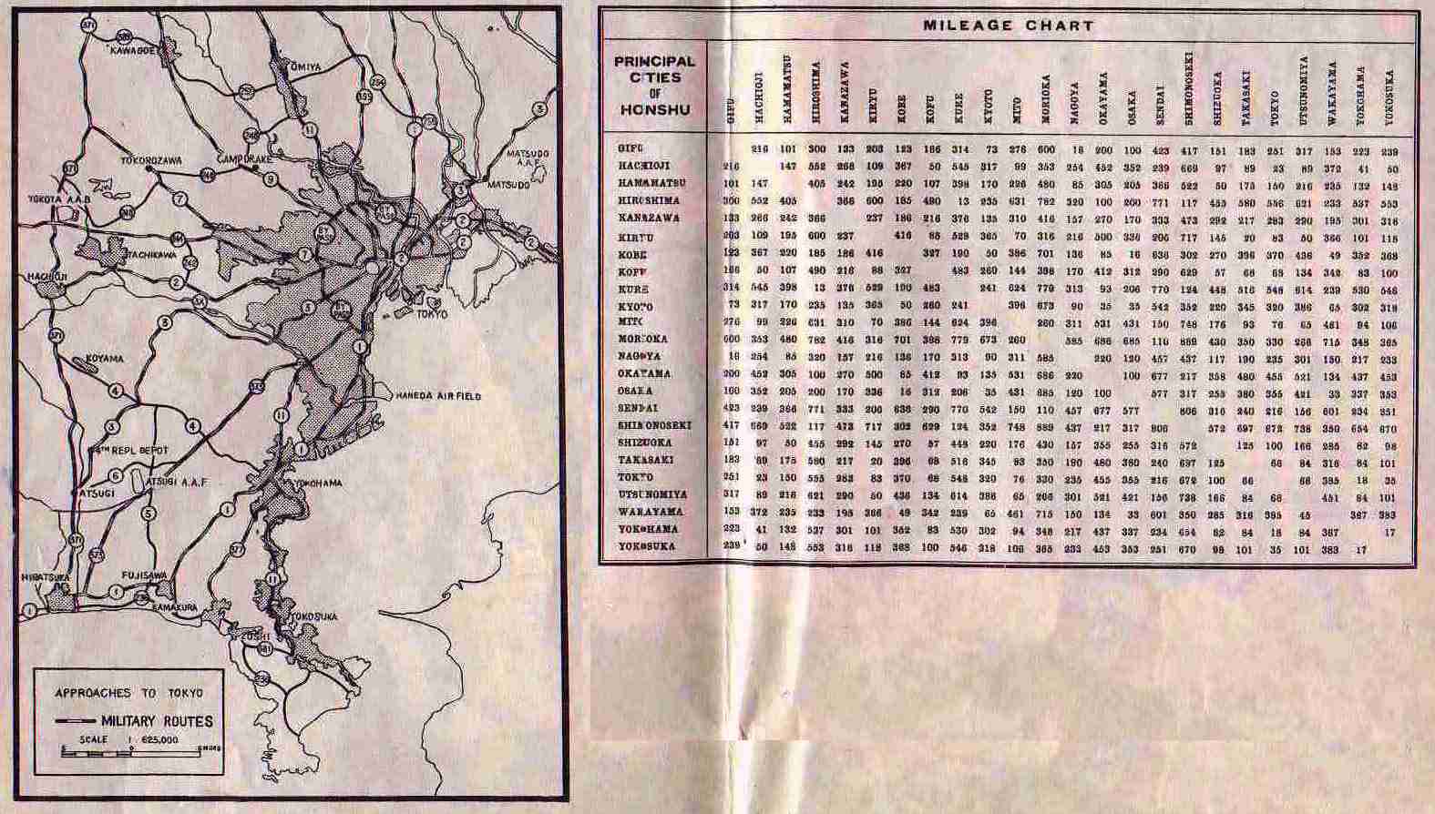
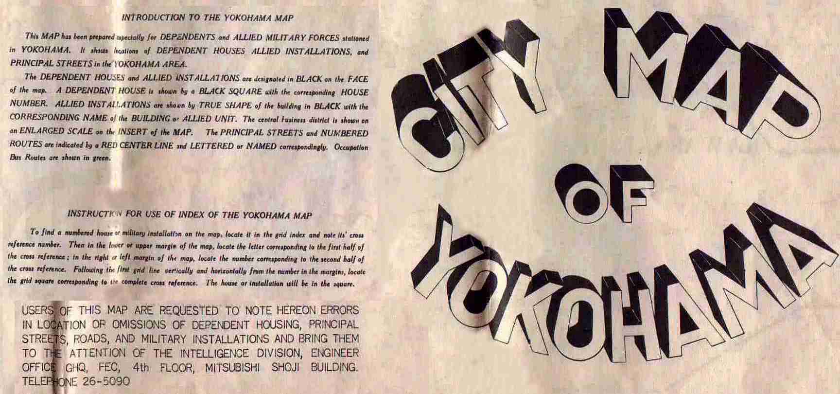
| TITLE - Left side - Small Kanto Plains map, milage chart 15ymph1.jpg 139,107 bytes | TITLE - Right side - Remarks 15ymph3.jpg 98,281 bytes |
SCALE = 1:25,000 (see more area - further away)
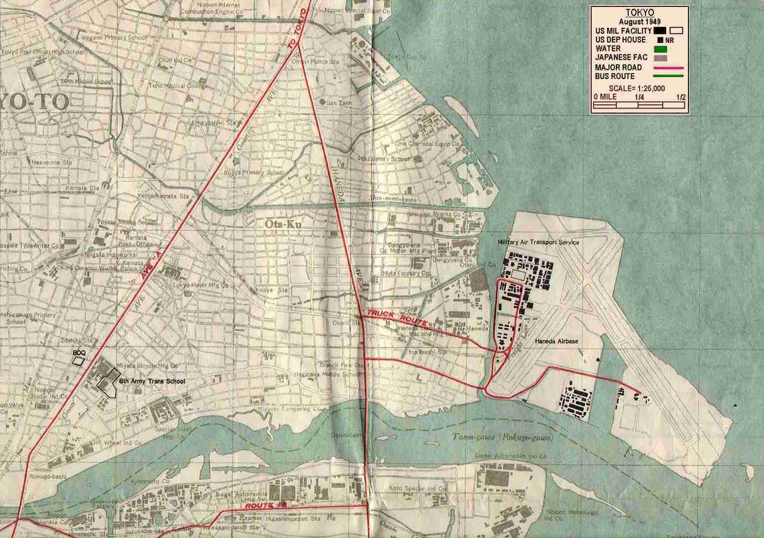
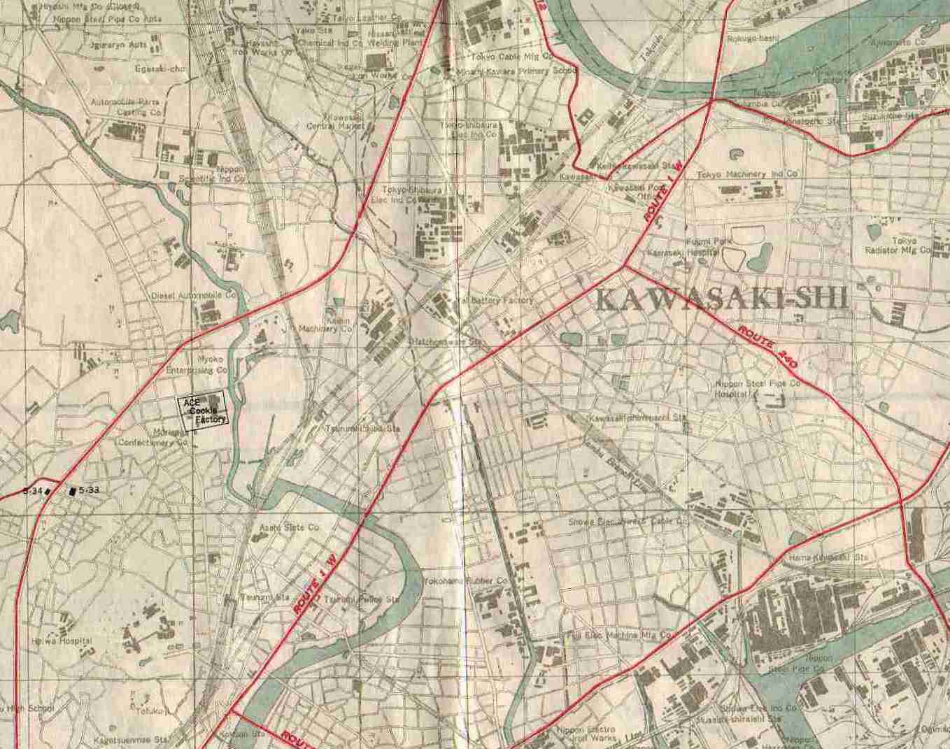
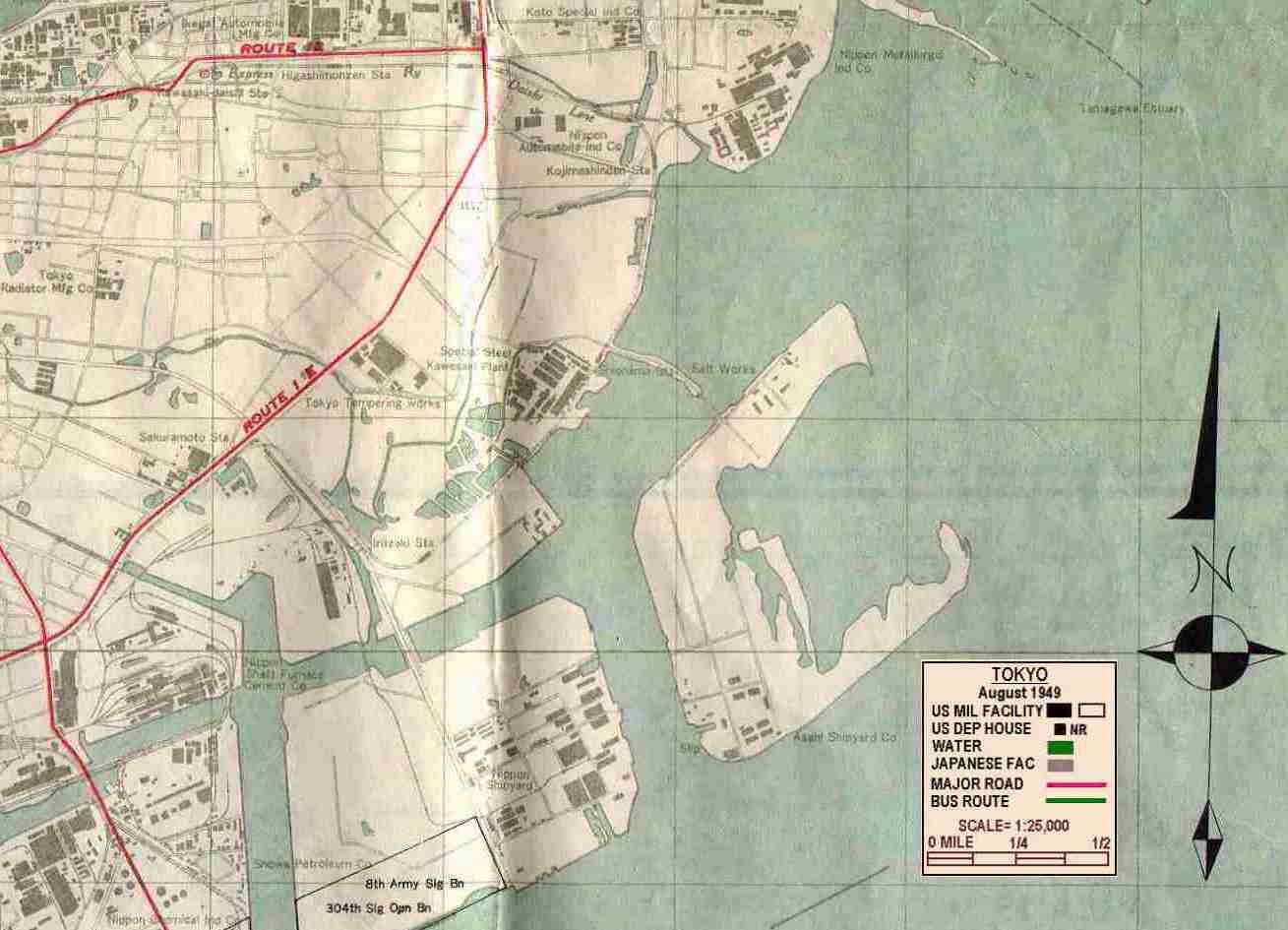
| TOKYO - SOUTH WEST SECTION - 15map04.jpg - 121,6761 bytes | MIDDLE 15map08.jpg - 131,798 bytes | TOKYO - SOUTH EAST SECTION - 15map05.jpg - 143,567 bytes |
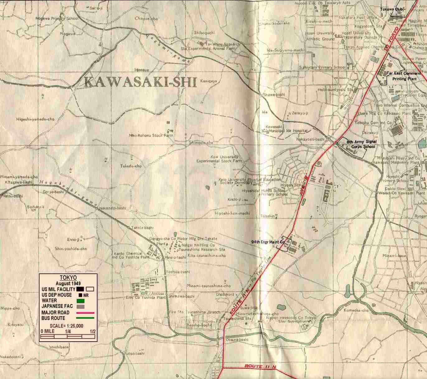
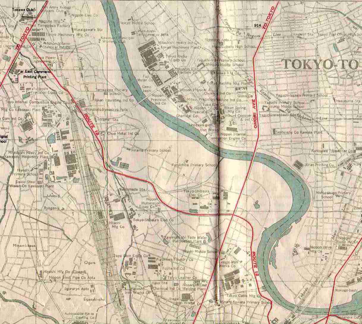
| YOKOHAMA / TOKYO WEST BOUNDARY - SW Tokyo, NW Yokohama - 15map03.jpg - 98,093 bytes | MIDDLE - includes 2 "dependent" quarters -15map09.jpg - 123,078 bytes |
YOKOHAMA / TOKYO EAST BOUNDARY - SE Tokyo, NE Yokohama - 15map06.jpg - 78,816 bytes |
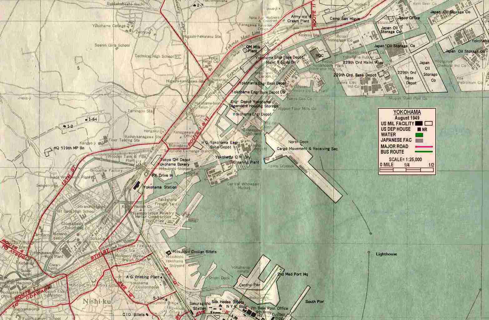
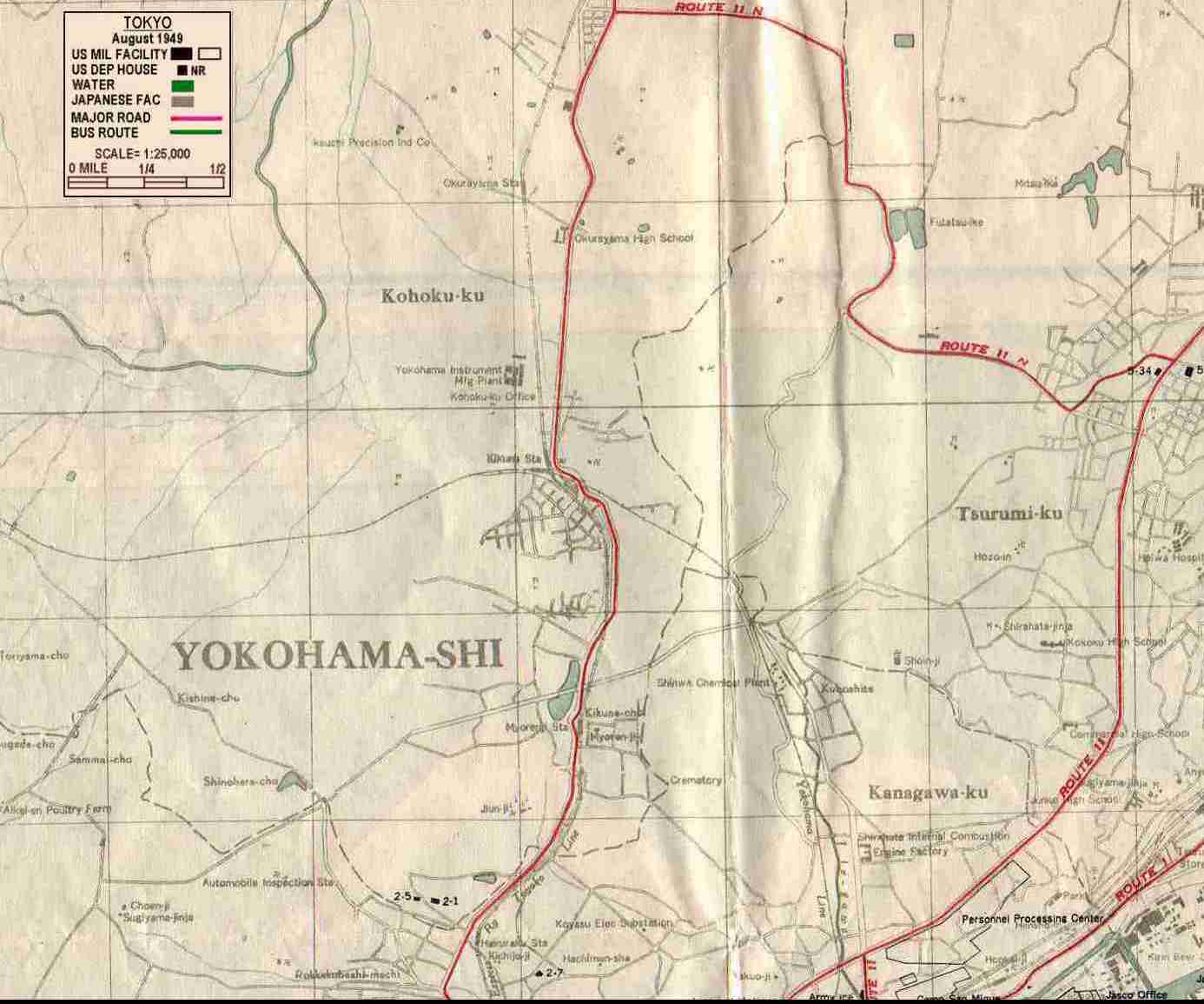
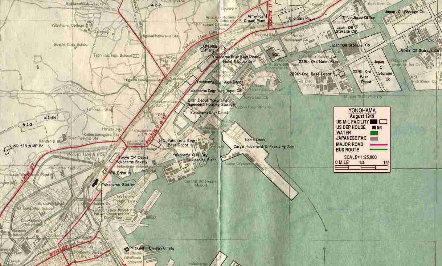
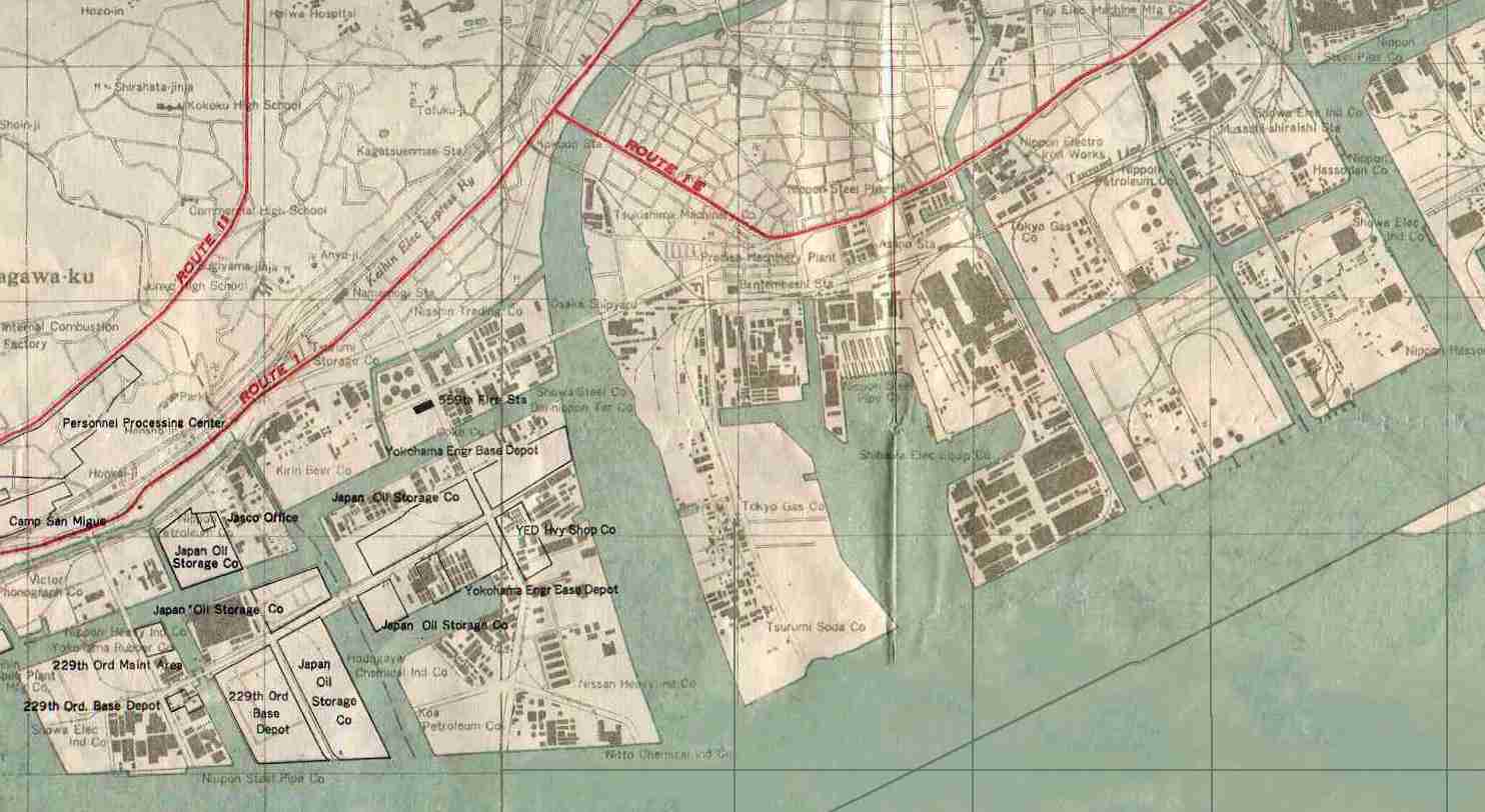
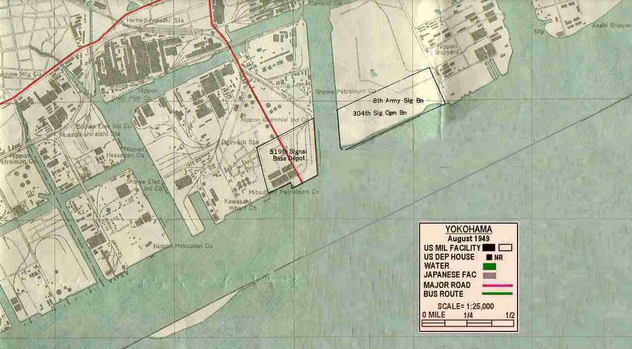
| YOKOHAMA CITY NORTH WEST SECTION - includes 3 "dependent" quarters - 15map022.jpg - 108,498 bytes | MIDDLE 15map10.jpg - 95,140 bytes | YOKOHAMA CITY NORTH EAST SECTION - 15map07.jpg - 62,770 bytes |
| YOKOHAMA CITY - DOWNTOWN TO "BEACH" SECTION - To road to Yokosuka - 15coord.jpg - 181,417 bytes | ||
Additional maps of interest.
| Tokyo - Yokohama - Kanto Plains Area |  |
| NEW MADE LAND: Graphical view of how the city of Yokohama has been enlarged by "dredging" the ocean floor and "filling" the original shore line seaward. | 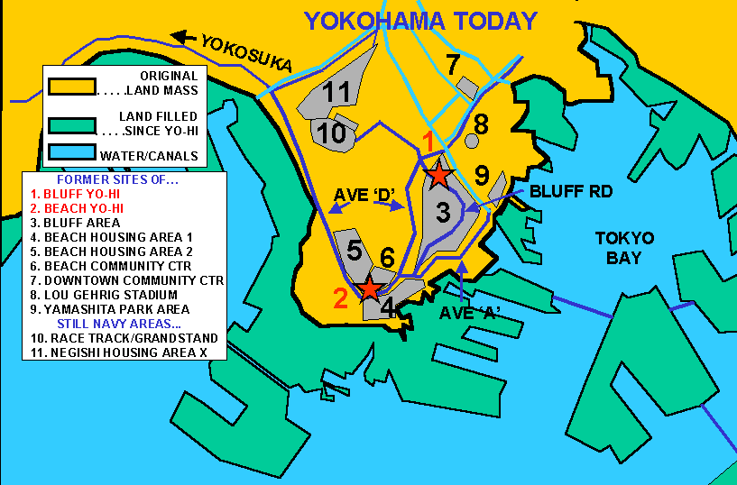 |
| NEW MADE LAND: Display of the actual areas constructed in the 50's and 60's. | 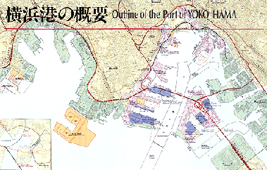 |
| FUJI-SAN - Did you climb Fuji? Judy Johnson Zerbe (Class 1951) did in 1947, on the yellow route - 1935 map. | 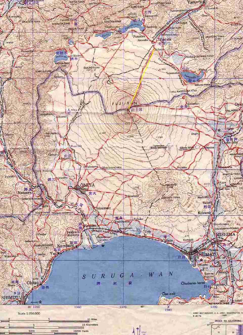 |