 |
 |
 |
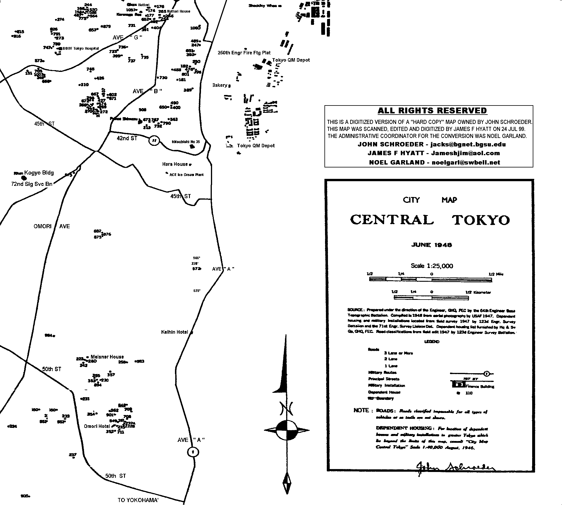
1948 MAP OF TOKYO
ALL RIGHTS RESERVED
Maps are for "viewing on this page only", and may not be used in any other form -- including "linking to" from another web site or "downloading" -- without written permission of one of the persons listed below.
| Noel Garland | noelgarl@swbell.net | |
| James F Hyatt | Jameshjim@aol.com | |
| John Schroeder | jacks@bqnet.bgsu.edu |
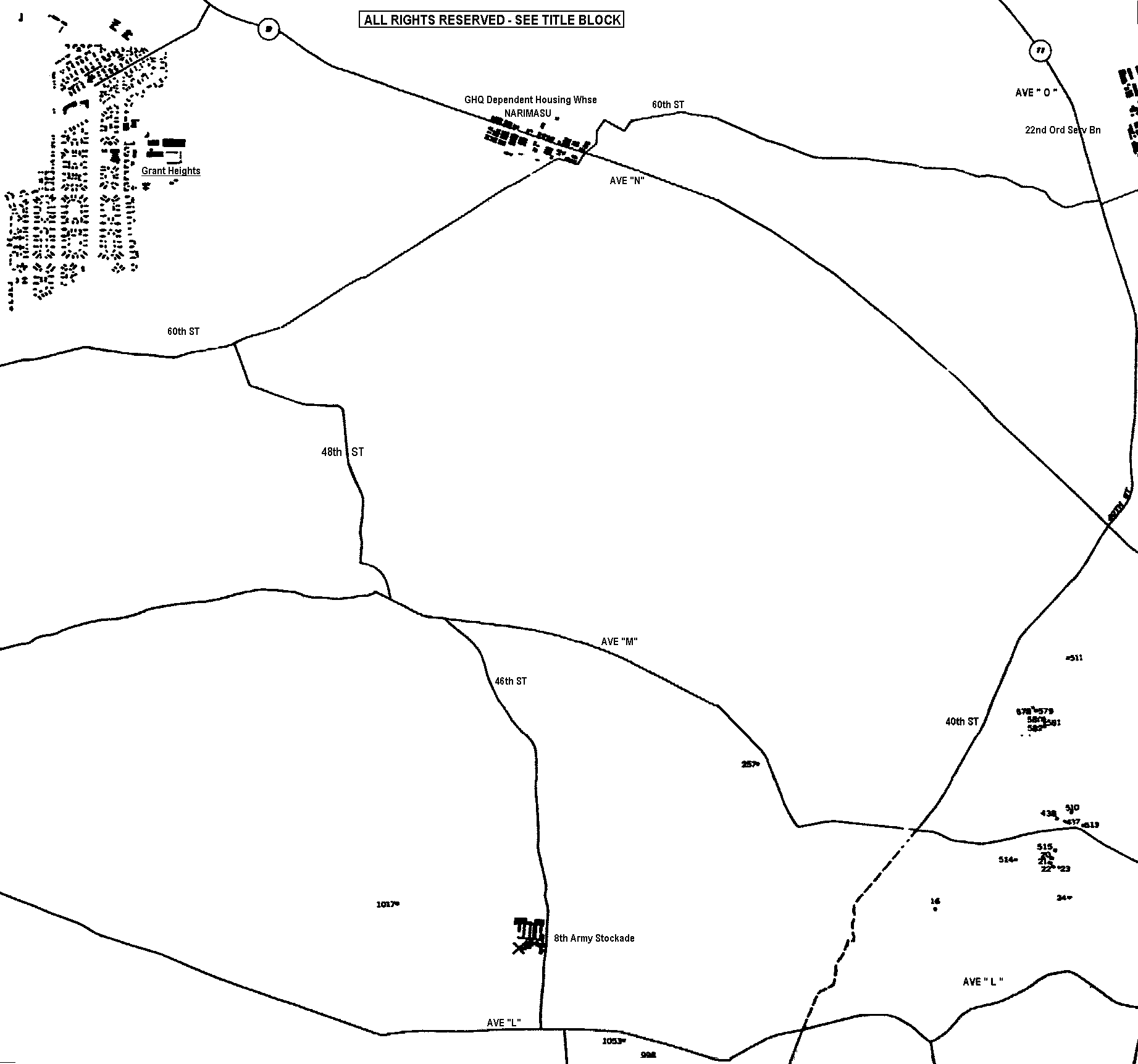
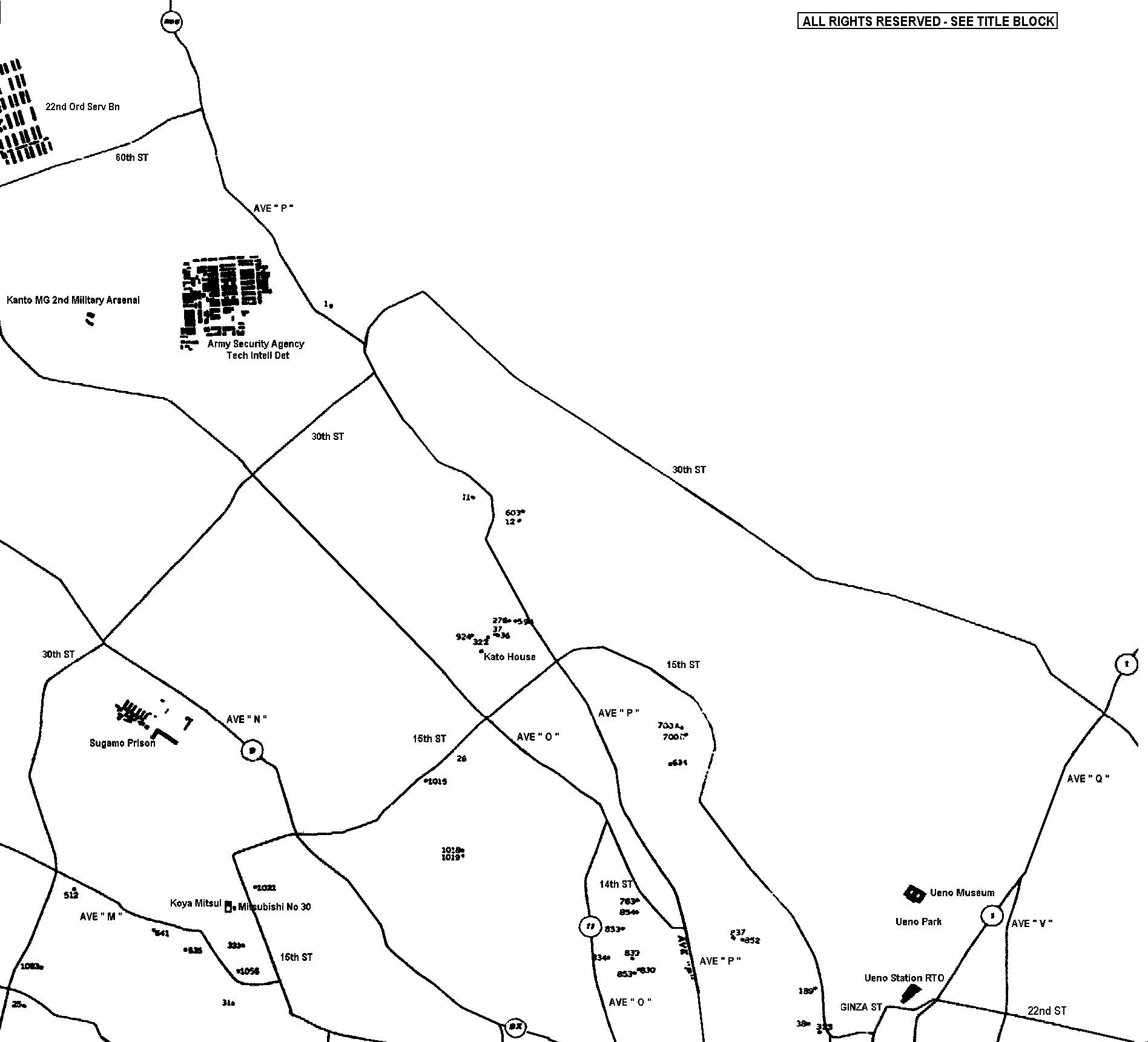
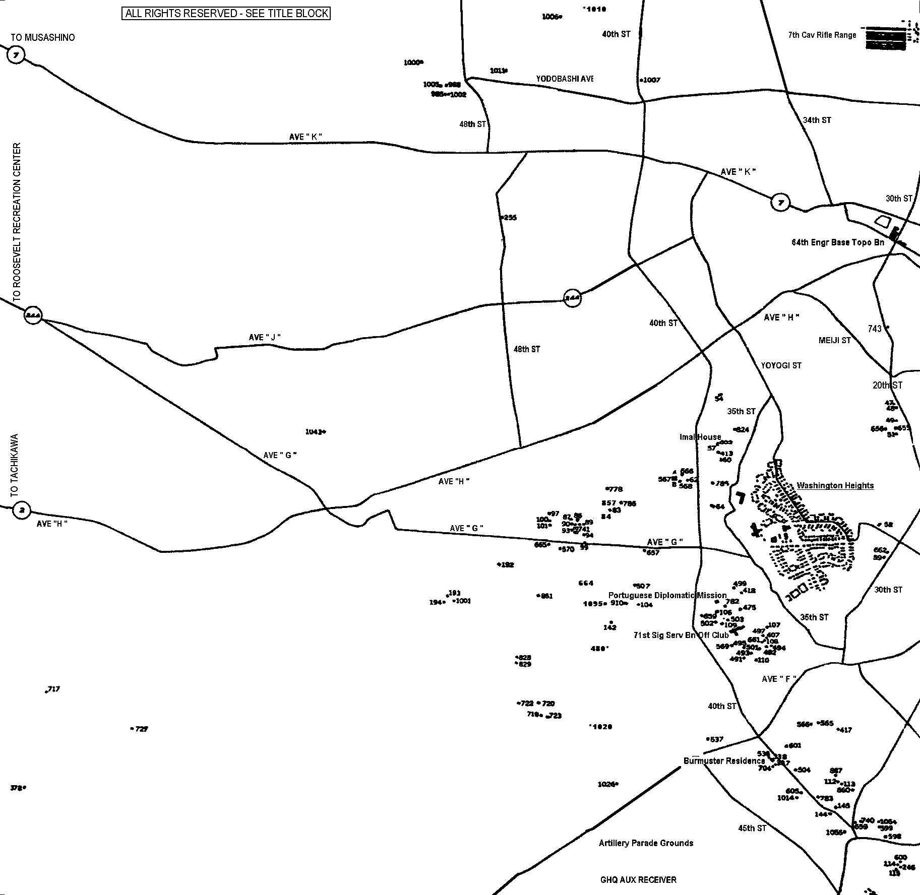
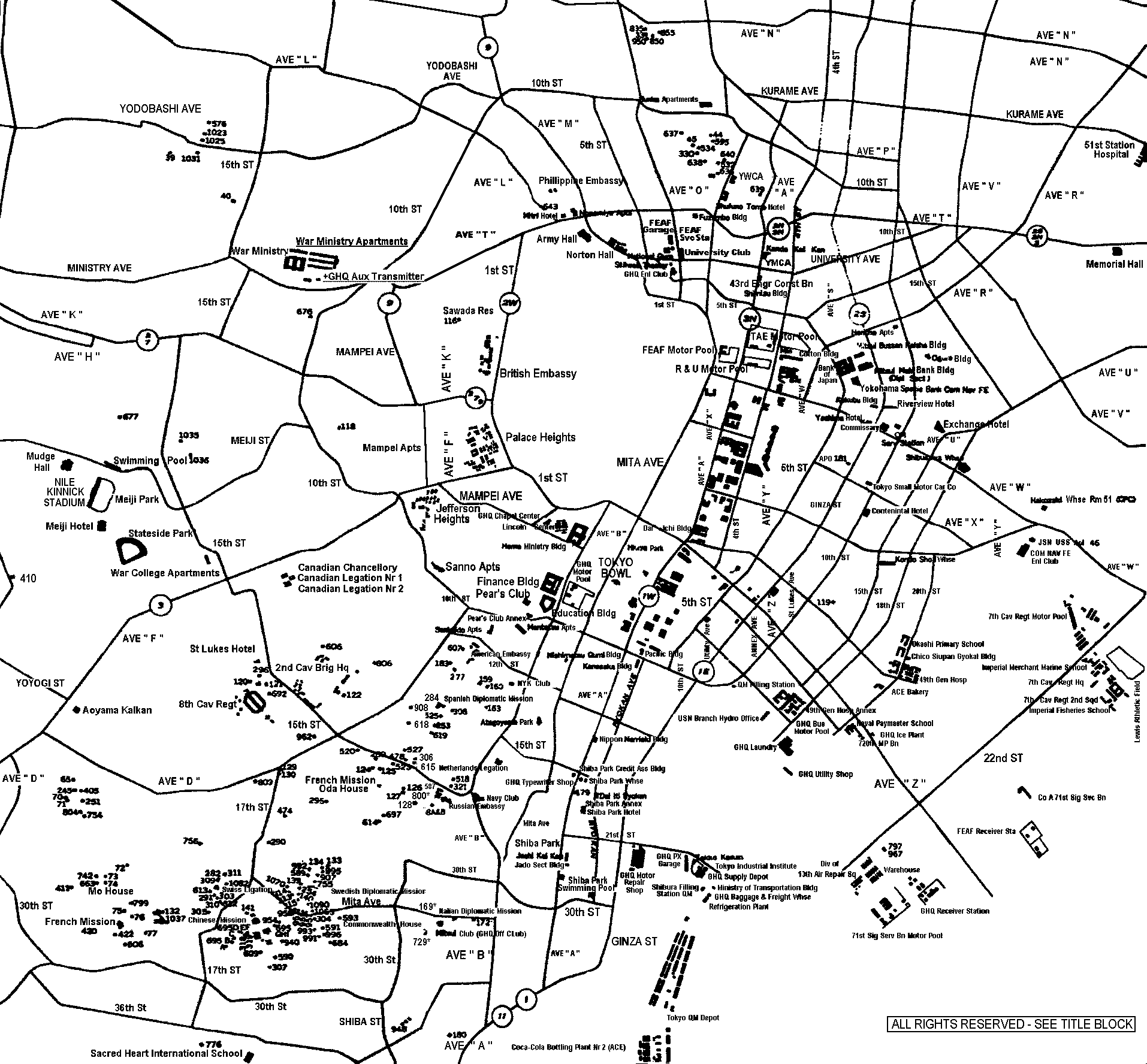
The digitized version of the 1948 Tokyo Map as seen on this web site was made from a "hard copy" map -- owned by John Schroeder. The digitized version was created on 24 July 1999 by James Hyatt. During the scanning and editing process, the digitized map was modified in several ways to make it more legible - thus there are some differences between the digitized map and the "hard copy" map. Questions concerning this digitized map should be directed to James F Hyatt.
* * * WARNING * * *
These 1948 Tokyo map files are HUGE (physically, and in "byte" size), and attempting to access them may "severely task" the capabilities of your equipment - and result in a "CRASH". Thus, you must take precautions, and a conscious decision to proceed. The map was created LARGE so as to permit one to actual see and read the detail in the map - else it is worthless.
To minimize the risks involved in "crashes" - it is recommended you "quit" ALL applications BEFORE attempting to access the files - except of course your "browser". Further we offer you two options -- neither of which we guarantee will be "crash" free - 1) for those with 20-32+ meg's of RAM we offer one map, and 2) for those below 20, another map (these maps do not show the detail as well as in the other map as they have been altered to reduce the "size" ).
* * * * *
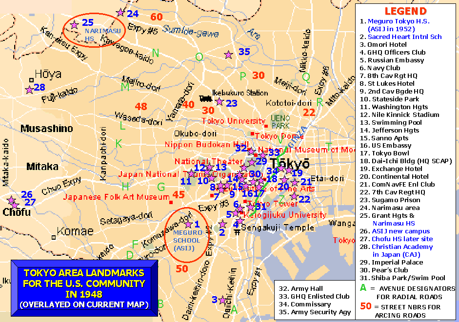
Before you scroll down to view the HUGE maps, I suggest you visit this graphical representation -- which was prepared by a YOHI alumni based upon the detail within the maps themselves, and other sources. The graphical representation will orient you to what you will see, or want to see, when you get to the HUGE maps.
* * * * *
HUGE MAP VIEWING INSTRUCTIONS
* *OPTION 1 - 20meg of RAM and above * *
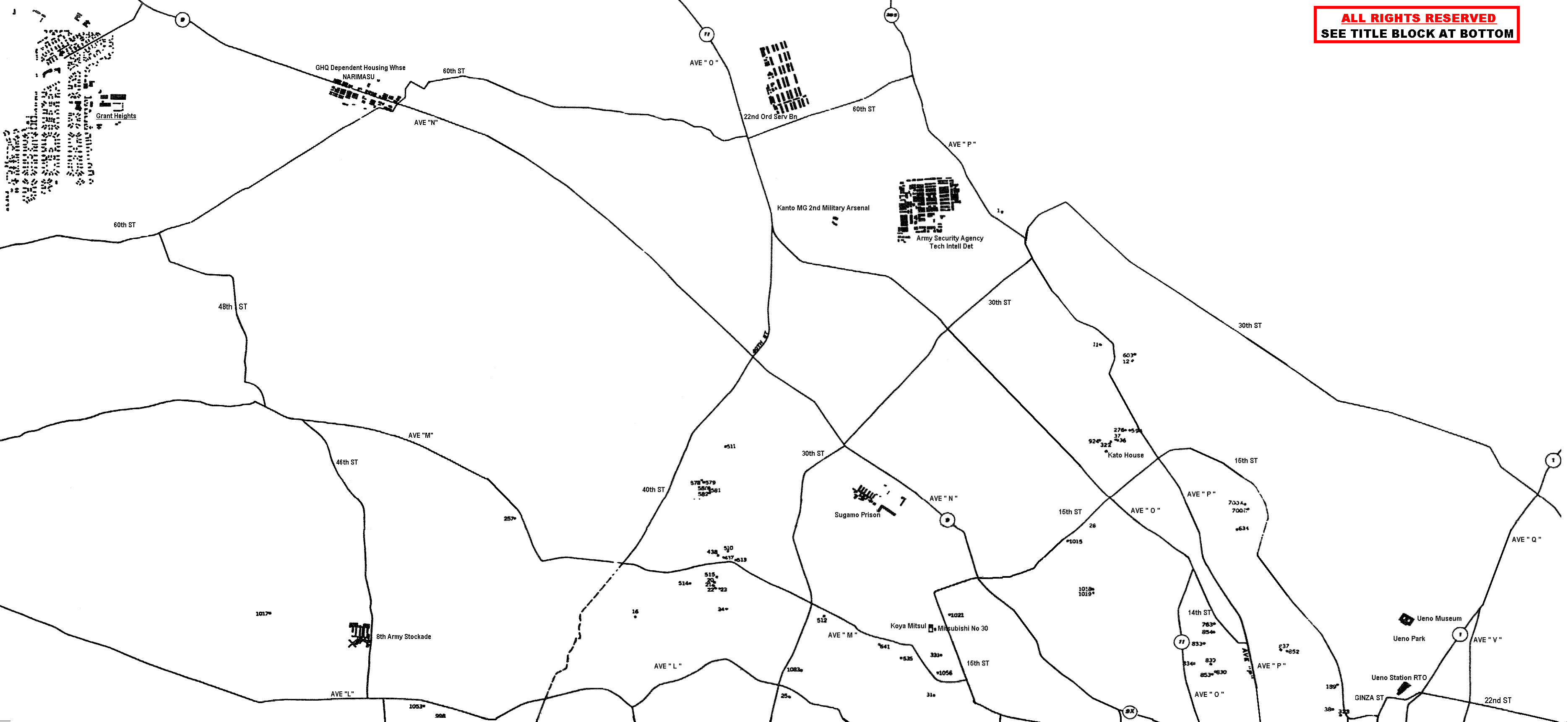
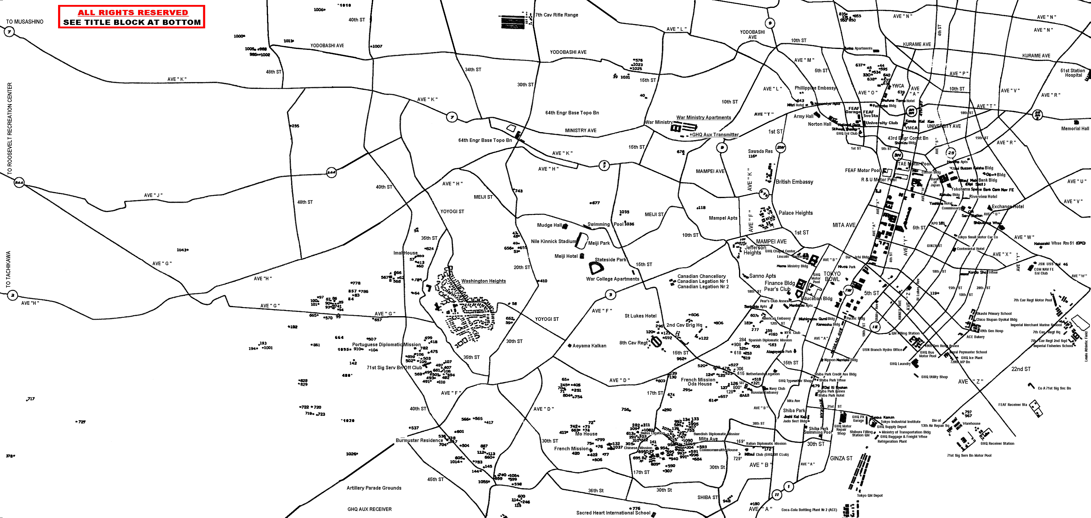
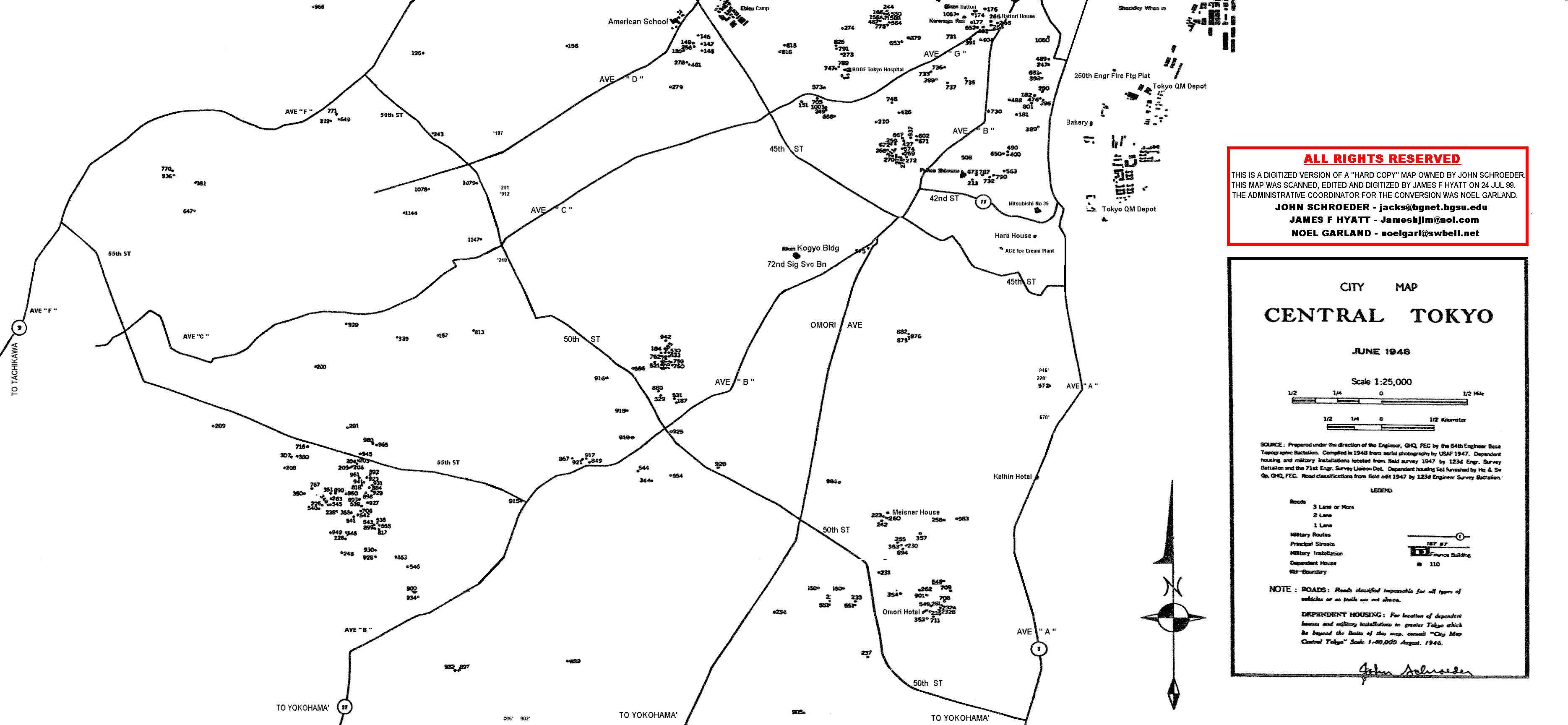
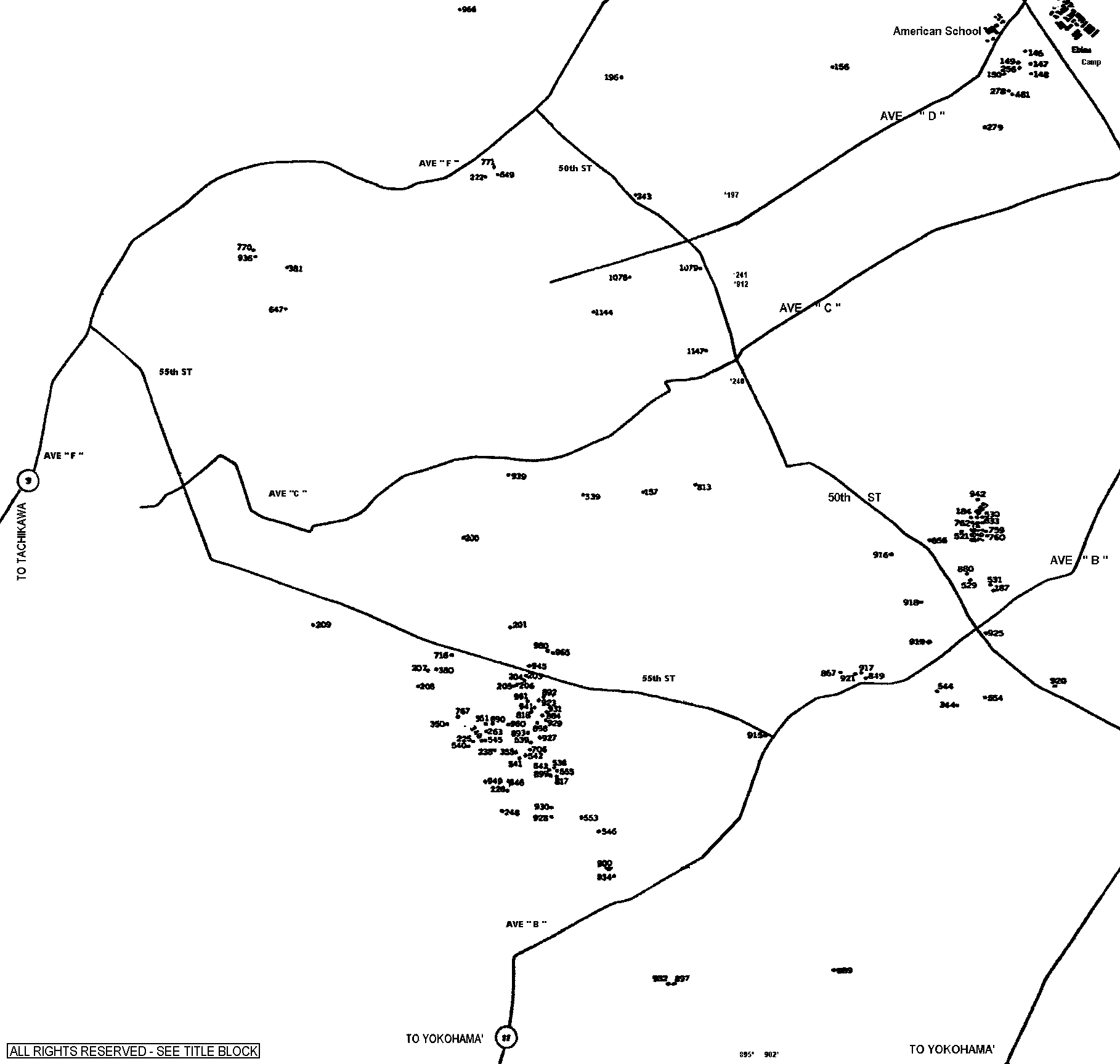
The digitized map is divided horizontally into 3 sections (top, middle, bottom) as depicted in a "thumbnail" map below. The 3 parts are represented by the three colored rectangles. Clicking at any point within one of the rectangles will expand that rectangle into a much larger version -- whereby you can identify the features on the map. When you click on a rectangle, and the larger version loads, you will be located in the top left corner of that rectangle. From there you must scroll down and right to view the map.
The three sections of the map are HUGE files and will take some time to load - depends on your equipment. Follows are perhaps average "load times".
| MAP SECTION | FILE NAME | BYTES | MINUTES |
| TOP | 48tokyo1.gif | 102,232 | 1-2 |
| MIDDLE | 48tokyo2.gif | 264,616 | 2-3 |
| BOTTOM | 48tokyo3.gif | 139,958 | 1-2 |
|
|
|
* *OPTION 2 - 16meg of RAM and below * *
Using the above picture of Tokyo as a guide - envision the 3 sections you see are divided each in to 2 parts - one left side and one right side - then click on a link below to see that section
| LEFT SIDE | RIGHT SIDE |
| TOP (32209 bytes; 2-3 min) | TOP (38355 bytes; 2-3 min) |
| MIDDLE (46464 bytes; 2-3 min) | MIDDLE (110531; 3-4 min) |
| BOTTOM (29910 bytes; 2-3 min) | BOTTOM (59305; 2-3 min) |