 |
YOKOHAMA HARBOR LIGHTHOUSE |
|
YOKOHAMA HARBOR LIGHTHOUSE |
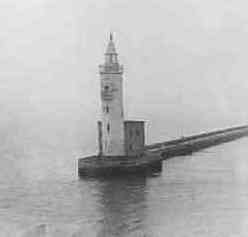
After WW II, one of the first structures recognizable to travelers sailing into Yokohama Harbor was the light house located at the end of a jetty which stretched out a great distance from the South end of Yamashita Park.
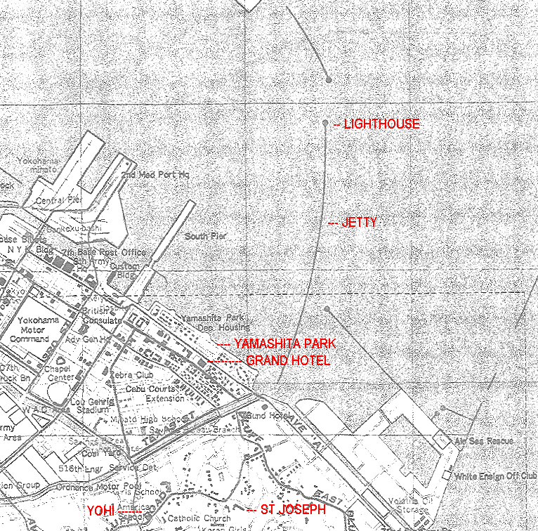
That jetty and lighthouse are depicted on this 1949 map, which also shows several other key features that existed in the 40's and 50's.
 |
![]()
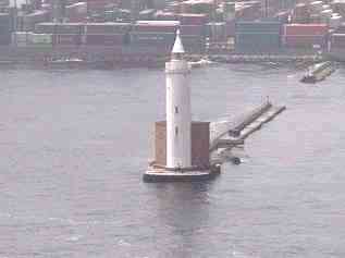
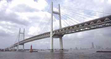
Below is a picture of the lighthouse I took in 1947 as I sailed into Yokohama Harbor, and another picture I took from the "BayBridge" sky-cam [on-line] in Jun 2002. Also included is a picture of the 'BayBridge' itself showing the location of the lighthouse below it. Of significance of course is the bridge itself, and the obvious creation of 'new land' shown just behind the June 2002 picture holding all the 'shipping containers' -- which did not exist in the 40's.
|
|
|||
AUGUST 1947 |
JUNE 2002 |
 |
Note on the right side, the end of the jetty that came from the North into the harbor -- it is also shown on the map.